📢 Loạt tính năng mới: Kết nối tài khoản Diễn Đàn với toàn bộ Thư Viện (Truyện/Thơ/Nhạc/Phim/Ẩm Thực)
Xin chào cả nhà!


Ban quản trị vừa hoàn tất một loạt tính năng mới, kết nối tài khoản Diễn Đàn với toàn bộ các khu vực Truyện, Thơ, Nhạc, Phim và Ẩm Thực. Xin tổng kết lại để mọi người tiện theo dõi và sử dụng:

1. Đăng nhập dùng chung toàn site
Chỉ cần 1 tài khoản Diễn Đàn, đăng nhập một lần là dùng được ở mọi khu vực. Nút "Đăng nhập / Đăng ký" đã thay cho "Giới thiệu / Trợ giúp" cũ ở đầu mỗi trang.

2. Thảo luận ngay dưới tác phẩm
Mỗi truyện, bài thơ, bài hát, phim, món ăn giờ có khung bình luận riêng ngay trên trang đọc/nghe/xem - không cần qua diễn đàn mới góp ý được. Bình luận đầu tiên sẽ tự tạo 1 chủ đề trong mục "💬 Thảo Luận Tác Phẩm Thư Viện" để mọi người cùng trao đổi.

3. Theo dõi tác phẩm
Bấm "🔔 Theo dõi tác phẩm" để nhận thông báo qua email ngay khi truyện có chương mới.

4. Yêu thích & Lịch sử đọc
Đánh dấu "⭐ Yêu thích" các tác phẩm ưng ý, và hệ thống tự ghi lại "🕘 Lịch sử đọc" mỗi khi bạn ghé đọc/nghe/xem - đồng bộ theo tài khoản, xem lại bất cứ lúc nào trong menu thành viên.

5. Huy hiệu hoạt động
Một vài huy hiệu nhỏ (bình luận viên, người theo dõi, người sưu tầm, thành viên kỳ cựu...) sẽ tự xuất hiện trên hồ sơ khi bạn hoạt động tích cực - hoàn toàn không phải hệ thống điểm/tiền thưởng, chỉ mang tính ghi nhận cho vui.

6. Ghi công người đóng góp
Tên người đăng nội dung (đánh máy, sưu tầm...) giờ sẽ tự động liên kết về hồ sơ Diễn Đàn nếu trùng với một tài khoản đang có trên diễn đàn.

7. Báo lỗi nội dung
Phát hiện lỗi chính tả, thiếu nội dung, ảnh hỏng... trong lúc đọc? Bấm "🚩 Báo lỗi nội dung" ngay trên trang, không cần rời khỏi tác phẩm đang xem.

8. Cải thiện giao diện trên điện thoại
Đầu trang và khu vực diễn đàn đã được chỉnh lại cho gọn gàng hơn trên màn hình nhỏ.

Rất mong nhận được góp ý thêm từ cả nhà để hoàn thiện dần. Cảm ơn mọi người đã luôn đồng hành cùng Việt Nam Thư Quán!

Diễn Đàn » English Club

Natural Disasters * North America

208 trả lời, 31.565 lượt xem — Trang 3 / 7
Lava Dome Falls Into Mount St. Helens

Sun Jul 3, 7:20 AM ET


MOUNT ST. HELENS NATIONAL MONUMENT, Wash. - A large part of the growing lava dome on Mount St. Helens fell Saturday, sending an ash plume above the crater rim, the U.S. Geological Survey reported. A rock fall had caused what scientists called a "substantial seismic signal" and knocked the chunk off the lava dome. The volcano was relatively quiet for the rest of the day.

The U.S. Geological Survey and the University of Washington have monitored the volcano closely since it rumbled back to life Sept. 23 with shuddering seismic activity that peaked above magnitude 3 as hot magma broke through rocks in its path.

Molten rock reached the surface Oct. 11, marking resumption of dome-building activity that had stopped in 1986. On March 8, it shot ash higher than 30,000 feet, but it has since maintained low-key activity, with wispy smoke regularly floating from the crater.

Scientists have said a more explosive eruption, possibly dropping ash within a 10-mile radius of the crater, is possible at any time.

http://news.yahoo.com/s/ap/20050703/ap_on_re_us/mount_st__helens
Đăng nhập để trả lời
0


http://vulcan.wr.usgs.gov/Imgs/Jpg/MSH/Images/MSH82_st_helens_plume_from_harrys_ridge_05-19-82_med.jpg
Đăng nhập để trả lời
0

April 15, 1980: Mount St. Helens spews ash and smoke.


http://www.foxnews.com
Đăng nhập để trả lời
0
Hurricane Dennis Steams Toward Jamaica

AP - 2 hours, 4 minutes ago

LES CAYES, Haiti - Hurricane Dennis dumped heavy rain on Haiti and strengthened Thursday as it spun toward Jamaica. Hurricane warnings also were posted in Cuba, including at the U.S. Navy base at Guantanamo Bay, and forecasters said the storm could strike the United States anywhere from Florida to Louisiana. Rivers burst out of their banks in dangerously deforested Haiti, where gusts uprooted a palm tree and flung it into a mud hut, injuring two people who were hospitalized in southern Les Cayes town.

http://news.yahoo.com/fc/world/hurricanes_and_tropical_storms


📎 HD
Đăng nhập để trả lời
0
AP - Thu Jul 7,11:02 AM ET

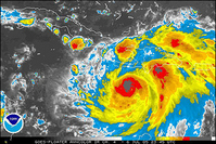
Map shows position and strength of hurricane Dennis.

(AP Graphic)

http://news.yahoo.com/photos/ss/events/ts/080304tropicalweathe/im:/050707/480/gfx97707071503

📎 HurricaneDennis
Đăng nhập để trả lời
0

Tourists Ordered Out of Florida Keys

AP - 49 minutes ago

MIAMI - The Florida Keys ordered an evacuation of tourists Thursday as Hurricane Dennis stormed through the Caribbean on a course that forecasters said might bring it to the state by the weekend. As of Thursday, the Keys were under a hurricane watch, which means winds of at least 74 mph and storm surges were possible by late Friday, and a tropical storm watch covered the state's southern section, including Miami.

http://news.yahoo.com/fc/world/hurricanes_and_tropical_storms

📎 Hurricans
Đăng nhập để trả lời
0
Hurricane Dennis Kills at Least 10 in Cuba

By ANITA SNOW, Associated Press Writer
1 hour, 9 minutes ago

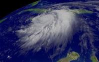
HAVANA - Hurricane Dennis lashed Cuba on its way to the Gulf of Mexico and the United States Friday, killing at least 10 people as it raked the Caribbean's largest island with torrential rains and 135 mph winds and forced thousands to flee the Florida Keys.

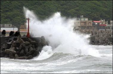
Winds and heaving surf tossed a lifeguard tower into the sea and the spray towered over a razor-wire fence at the U.S. detention camp for terror suspects at Guantanamo Bay, on the island's eastern end.

"It's arrived, with all its diabolical force," President Fidel Castro said of the Category 4 hurricane during an appearance on state television Friday afternoon. He said there were 10 deaths in southeastern Cuba — eight in Granma province and two in Santiago.

Another five people were earlier reported killed in Haiti, bringing the known overall death toll for the Caribbean to 15.

Top Cuban meteorologist Jose Ruberiea called Dennis an "extremely dangerous" storm.

An evacuation order was in effect in the Florida Keys, where officials feared Dennis could hit the island chain on its way to the Gulf of Mexico. Tornadoes could develop there, the U.S. Hurricane Center said Friday afternoon.

A Category 4 storm that strengthened Friday to 150 mph winds before weakening slightly, Dennis killed five people in Haiti, stranded tens of thousands, collapsed bridges, triggered landslides, inundated homes and blocked roads with downed power lines and trees in Haiti and Jamaica.

The eye made landfall on central Cuba's southern coast a second time shortly before 5 p.m. Friday was near the central provincial city of Santa Clara, about 95 miles east-southeast of Havana and about 145 miles south-southeast of Key West. Overnight, Dennis swiped a sparsely populated Cuban cape at Cabo Cruz jutting out far west.

More than 600,000 people left their homes to stay at government shelters or with family and friends, Cuban civil defense officials said.

Hurricane-force winds extended 65 miles with tropical storm force winds stretching another 160 miles. Dennis was moving northwest near 17 mph.

The first hurricane of the season sideswiped Haiti's southwestern peninsula and Jamaica's south and east coasts Thursday and dumped rain on the Dominican Republic.

In Jamaica, a rescue helicopter was to airlift food and emergency supplies to hundreds of stranded islanders in at least seven eastern towns cut off by knee-deep floodwaters, said Nadene Newsome, spokeswoman for the country's emergency management office.

"Flooding has affected every parish of the island and it will increase as long as the rain continues throughout the day" Friday, she said.

Although Dennis was losing some strength as it passed over Cuba, it was expected to remain a major hurricane as it emerged over the Florida Straits and into the southeastern Gulf of Mexico later Friday evening.

Forecasters predict the storm will hit the United States anywhere from Florida to Louisiana by Sunday or Monday, the fourth storm in as many weeks to disrupt oil production.

The lower Florida Keys, including Key West, were on hurricane warning, while the southern part of the state, including Miami and Naples, were on tropical storm warning.

A hurricane watch was issued for portions of the northeastern U.S. Gulf Coast from the Steinhatchee River westward to the mouth of the Pearl River.

The Cayman Islands, spared from a direct hit by the storm's overnight turn to the west, downgraded its hurricane warning Friday to a tropical storm watch.

Also largely spared was the U.S. detention camp on Cuba's extreme southeast end, holding about 520 terror suspects.

Heaving surf tore away a lifeguard tower at Windmill Beach and storm force winds reaching 40 mph destroyed a bus shelter. A few power lines and tree branches were knocked down and there was minor flooding.

"Actually, everybody fared real well," said Navy Cmdr. Anne Reese.

American troops fixed metal shutters over the steel mesh windows of some prison cells overlooking the sea at Camp Delta, which is just 150 yards from the ocean.

Hurricane Center forecasters warned Cuba's southeast Sierra Maestra Mountains could get up to 15 inches of rain, with about 10 inches falling on Jamaica's coffee-producing Blue Mountains.

In Haiti, young men were charging US$2 to carry travelers and their possessions across the Grand Goave River, which overflowed and caused 40 131 feet of a 328-foot bridge to collapse Thursday, cutting off Haiti's southwestern peninsula.

An Associated Press Television News Reporter saw four people die when the bridge collapsed. Rescue workers were looking for missing people and feared the death toll would rise.

Fristino Fleurinon, 18, said he carried at least 10 people across the river on his shoulders.

"People have to sell their things, and they have to come and go back to where they came from," he said.

Others refused to pay and struggled to carry tools, sacks of rice and animals across. One man's five goats were swept away as he tried to cross. Another man carried a baby through the waist-deep water.

Elsewhere on the deforested island, wind gusts uprooted a palm tree and flung it into a mud hut, killing a fifth person in the southern town of Les Cayes, the Red Cross said.

In Jamaica, floods and debris blocked the road leading from the capital, Kingston, to the storm-battered east around Yallahs town.

A man there narrowly escaped from a car swept away by fast-flowing floodwater on Wednesday night, a day before the hurricane passed.

In Cuba's southern city of Cienfuegos, expected to bear much of the storm's brunt, residents rushed Friday morning to board up windows with anything to hand: plywood, metal sheeting — even cardboard.

"Every time hurricanes pass through, we suffer because we are at the southernmost point," said Antonio Leonardo. "With a hurricane as strong as this one, there's a lot of fear of losing one's home."

Residents fled inland on bicycle and on foot, some carrying pet dogs. Long lines formed at gas stations and at government ration centers distributing bread.

Earlier in the week, hundreds of tourists staying in the keys along the southern coast were taken to hotels in Havana and northern Varadero beach resort. Thousands of students at government boarding schools were sent home, and livestock moved to higher ground.

The largest and most populous Caribbean island with 11.2 million people, Cuba suffers few hurricane casualties because the government cautiously evacuates people en masse, sometimes forcefully.

The hurricane center's lead forecaster, Martin Nelson, said it was the first time the Atlantic hurricane season had four named storms this early since record-keeping began in 1851. The season runs from June 1 to Nov. 30.

Last year, four catastrophic hurricanes — Charley, Frances, Ivan and Jeanne — tore through the Caribbean with a collective ferocity not seen in years, causing hundreds of deaths and billions of dollars in damage.

http://news.yahoo.com/s/ap/20050708/ap_on_re_la_am_ca/hurricane_dennis_8;_ylt=AiQAM.05jt9FifJEW0cWsDIbLisB;_ylu=X3oDMTBiMW04NW9mBHNlYwMlJVRPUCUl
Đăng nhập để trả lời
0
Typhoon Haitang lashes northeastern Taiwan; schools and offices closed

1 hour, 32 minutes ago

TAIPEI, Taiwan (AP) - Typhoon Haitang lashed communities along Taiwan's northeast coast Monday as officials ordered schools, government offices and financial markets to close.

Torrential rains poured on the capital Taipei at daybreak while powerful winds uprooted trees and dislodged billboards in the northern part of the island. The storm's full impact was due in the late afternoon when its eye was forecast to pass a point just south of Taipei.

Taipei's normally pulsating streets were almost deserted, and air and rail service came to a standstill.

Residents spent the last hours before the storm's arrival loading up on provisions, and battening down doors and windows. Supermarkets were jammed, as media outlets warned of potential supply disruptions over coming days.

Prime Minister Frank Hsieh cautioned against complacency, telling Taiwanese in the central and southern parts of the island to take precautions against the storm's approach, despite its relatively northern course.

Typhoons and storms frequently batter Taiwan between July and September. Haitang, the Chinese name of a flower, was the first typhoon to hit the island this year.

http://news.yahoo.com/s/cpress/20050718/ca_pr_on_wo/wea_taiwan_typhoon_1;_ylt=Ap.ytqJkMCk6XFp8MjmnnX1W8ZoB;_ylu=X3oDMTBiMW04NW9mBHNlYwMlJVRPUCUl

>>>>>>>>>>>>>>

http://www.tienphongonline.com.vn/Tianyon/Index.aspx?ArticleID=16056&ChannelID=5


📎 TaiwanTyphoon
Đăng nhập để trả lời
0
<Bài viết đã được chỉnh sửa lúc 2005-07-21 10:49:11HongYen>

Thousands of people in the storm's path have been evacuated


Tuesday, 19 July, 2005, 14:55 GMT 15:55 UK

Typhoon Haitang reaches SE China


A powerful typhoon has hit the south-eastern coast of China, hours after battering Taiwan, where it caused the deaths of four people.
More than 800,000 people have been evacuated from the provinces of Fujian and Zhejiang.

Typhoon Haitang slowed as it approached mainland China.

But the first big storm of the season was still packing winds of up to 119km/h (74 mph) when it made landfall, Chinese meteorologists said.

Four people were killed and nearly 60 others were injured when Typhoon Haitang hit Taiwan on Monday.

Millions of dollars' worth of flood and storm damage was also reported.

http://news.bbc.co.uk/2/hi/asia-pacific/4696429.stm

&gt;&gt;&gt;&gt;&gt;&gt;&gt;&gt;&gt;&gt;&gt;&gt;&gt;&gt;&gt;

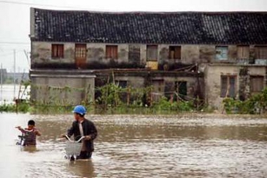
A Chinese man and his son struggle forward with their bicycles in a flooded street in Xiaojiang township of Wenzhou city in east China's Zhejiang province July 20, 2005. Torrential rains brought about by typhoon Haitang struck Wenzhou over the last two days, leaving one person dead and causing an economic loss of 2.16 billion yuan (US$261 million), according to the city flood control and drought relief headquarters. (China Newsphoto/Reuters)

📎 mdf614878
Đăng nhập để trả lời
0
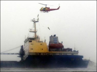
A helicopter rescues crew members from a ship that partially sank off Kaohsiung, southern Taiwan. The death toll after Typhoon Haitang tore through Taiwan has risen to 12 with two people still missing, as downpours continued to lash parts of the island.(AFP/Tung Chuan-Chih)


📎 Typhoon
Đăng nhập để trả lời
0
Typhoon Leaves 15 Dead in China, Taiwan

By VOA News
20 July 2005


Heavy clouds hang over Hangzhou, capital city of east China's Zhejiang Province, as Typhoon Haitang approaches


A typhoon that left at least 15 people dead has been downgraded to a tropical storm after battering Taiwan and southeastern China with heavy rains and powerful winds.

Three of the deaths were reported in China, where Typhoon Haitang slammed into the coastal provinces of Fujian and Zhejiang Tuesday and caused more than one million people to flee their homes.

Typhoon Haitang earlier left a trail of destruction in Taiwan. It washed away roads and caused more than $14 million in damage to the island's agricultural sector.

Taiwanese authorities say the death toll has risen to 12 from four reported earlier.

Some information for this report provided by AP and AFP.

http://www.voanews.com/english/2005-07-20-voa63.cfm
Đăng nhập để trả lời
0

Thursday January 27, 11:42 AM

Moderate earthquake hits near India's Nicobar islands,

Hong Kong seismologists say
A moderate earthquake struck near remote Indian islands that were jolted in recent weeks by aftershocks from last month's giant quake that sparked a devastating tsunami across southern Asia, Hong Kong seismologists reported Thursday.

The 5.6-magnitude quake hit near the Nicobar islands in the Bay of Bengal at 1:36 a.m. Thursday (1736 GMT Wednesday), the Hong Kong Observatory said.

The seismologists said the tremor's epicenter was about 345 kilometers (214 miles) north-northwest of Banda Aceh, the capital of the Indonesian province hit hard Dec. 26 by the 9.0-magnitude quake and the tsunami it spawned

http://asia.news.yahoo.com/050127/ap/d87s66480.html
Đăng nhập để trả lời
0
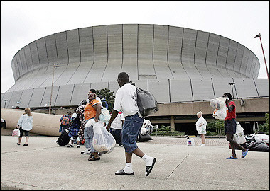
AFP - Sun Aug 28, 5:50 PM ET New Orleans area residents, seeking refuge from oncoming Hurricane Katrina, arrive with bags of belongings at the Superdome which has been set up as an emergency shelter, in New Orleans, Louisiana(AFP/James Nielsen)

📎 aaas
Đăng nhập để trả lời
0
Hurricane Could Leave 1 Million Homeless

By MATT CRENSON, AP National Writer

2 hours, 10 minutes ago


When Hurricane Katrina hits New Orleans on Monday, it could turn one of America's most charming cities into a vast cesspool tainted with toxic chemicals, human waste and even coffins released by floodwaters from the city's legendary cemeteries.

ADVERTISEMENT

Experts have warned for years that the levees and pumps that usually keep New Orleans dry have no chance against a direct hit by a Category 5 storm.

That's exactly what Katrina was as it churned toward the city. With top winds of 165 mph and the power to lift sea level by as much as 28 feet above normal, the storm threatened an environmental disaster of biblical proportions, one that could leave more than 1 million people homeless.

"All indications are that this is absolutely worst-case scenario," Ivor van Heerden, deputy director of the Louisiana State University Hurricane Center, said Sunday afternoon.

The center's latest computer simulations indicate that by Tuesday, vast swaths of New Orleans could be under water up to 30 feet deep. In the French Quarter, the water could reach 20 feet, easily submerging the district's iconic cast-iron balconies and bars.

Estimates predict that 60 percent to 80 percent of the city's houses will be destroyed by wind. With the flood damage, most of the people who live in and around New Orleans could be homeless.

"We're talking about in essence having — in the continental United States — having a refugee camp of a million people," van Heerden said.

Aside from Hurricane Andrew, which struck Miami in 1992, forecasters have no experience with Category 5 hurricanes hitting densely populated areas.

"Hurricanes rarely sustain such extreme winds for much time. However we see no obvious large-scale effects to cause a substantial weakening the system and it is expected that the hurricane will be of Category 4 or 5 intensity when it reaches the coast," National Hurricane Center meteorologist Richard Pasch said.

As they raced to put meteorological instruments in Katrina's path Sunday, wind engineers had little idea what their equipment would record.

"We haven't seen something this big since we started the program," said Kurt Gurley, a University of Florida engineering professor. He works for the Florida Coastal Monitoring Program, which is in its seventh year of making detailed measurements of hurricane wind conditions using a set of mobile weather stations.

Experts have warned about New Orleans' vulnerability for years, chiefly because Louisiana has lost more than a million acres of coastal wetlands in the past seven decades. The vast patchwork of swamps and bayous south of the city serves as a buffer, partially absorbing the surge of water that a hurricane pushes ashore.

Experts have also warned that the ring of high levees around New Orleans, designed to protect the city from floodwaters coming down the Mississippi, will only make things worse in a powerful hurricane. Katrina is expected to push a 28-foot storm surge against the levees. Even if they hold, water will pour over their tops and begin filling the city as if it were a sinking canoe.

After the storm passes, the water will have nowhere to go.

In a few days, van Heerden predicts, emergency management officials are going to be wondering how to handle a giant stagnant pond contaminated with building debris, coffins, sewage and other hazardous materials.

"We're talking about an incredible environmental disaster," van Heerden said.

He puts much of the blame for New Orleans' dire situation on the very levee system that is designed to protect southern Louisiana from Mississippi River floods.

Before the levees were built, the river would top its banks during floods and wash through a maze of bayous and swamps, dropping fine-grained silt that nourished plants and kept the land just above sea level.

The levees "have literally starved our wetlands to death" by directing all of that precious silt out into the Gulf of Mexico, van Heerden said.

It has been 40 years since New Orleans faced a hurricane even comparable to Katrina. In 1965, Hurricane Betsy, a Category 3 storm, submerged some parts of the city to a depth of seven feet.

Since then, the Big Easy has had nothing but near misses. In 1998, Hurricane Georges headed straight for New Orleans, then swerved at the last minute to strike Mississippi and Alabama. Hurricane Lili blew herself out at the mouth of the Mississippi in 2002. And last year's Hurricane Ivan obligingly curved to the east as it came ashore, barely grazing a grateful city.

http://news.yahoo.com/s/ap/20050828/ap_on_re_us/katrina_the_big_one_1


📎 aocean
Đăng nhập để trả lời
0
<Bài viết đã được chỉnh sửa lúc 2005-08-29 08:40:47HongYen>
U.S. oil prices surged to a record above $70 a barrel on August 29, 2005 as one of the country's biggest storms tore through the U.S. Gulf of Mexico, forcing oil producers and refiners to shut down operations. National Oceanic and Atmospheric Administration satellite image of Hurricane Katrina in the Gulf of Mexico on Sunday. (NOAA/Handout/Reuters)


📎 aggg
Đăng nhập để trả lời
0
Strong Quake Hits Near Tokyo; 27 Injured

1 hour, 37 minutes ago


TOKYO - A magnitude-6.0 earthquake shook the Tokyo area Saturday, injuring at least 27 people, rattling buildings across the sprawling capital and temporarily suspending flights and train services.

The earthquake struck at 4:35 p.m. (3:35 a.m. EDT) and was centered about 55 miles underground in Chiba prefecture, just east of Tokyo, Japan's Meteorological Agency said. There was no danger of tsunami, the agency said.

The quake was the strongest to hit the capital since 1992 as measured on Japan's sliding scale of tremor intensity, the Kyodo News agency reported.

The quake injured at least 27 people, including five people hit by a falling signboard at a supermarket in neighboring Saitama prefecture, Kyodo said. There were some 50 cases of people briefly trapped in elevators.

The Meteorological Agency gave the quake an initial reading of magnitude 5.7 but later upgraded its strength.

Power in eastern Japan was not disrupted but Tokyo's main international airport in Narita briefly closed its runways. Bullet trains between Tokyo and western coastal areas also were suspended, but air and train services resumed later in the evening.

Tokyo has not suffered a major earthquake since a 1923 temblor that killed 140,000 people, but many experts say the capital is overdue for another strong quake. A government report last year said a powerful earthquake under Tokyo could kill as many as 12,000 people and destroy 850,000 homes.

Japan sits at the juncture of four tectonic plates, or moving slabs of the earth's outer crust, and is one of the world's most quake-prone regions.

A magnitude-5 quake can damage homes and other buildings if it is centered in a heavily populated area. A magnitude-6.8 temblor struck the northern Japanese prefecture of Niigata last October, killing 40 people and injured more than 2,700.

http://news.yahoo.com/s/ap/20050723/ap_on_re_as/japan_earthquake
Đăng nhập để trả lời
0
<Bài viết đã được chỉnh sửa lúc 2005-08-17 10:31:15HongYen>
Strong Earthquake Hits Tokyo, Buildings Sway

By Steve Herman
Tokyo
16 August 2005

Steve Herman Speaking with VOA's Victor Beattie - Download 669K
Listen to Steve Herman Speaking with VOA's Victor Beattie


A tsunami warning has been issued after a strong earthquake struck the Japanese capital Tokyo Tuesday morning.

VOA correspondent in Tokyo, Steve Herman, says the quake measured a 6.8 on the Richter scale, and caused buildings in downtown Tokyo to sway.

Train service has been suspended in the region, as well as work at a nuclear power plant.

Initial reports say about 80 people were injured in the northern city of Sendai when the roof of an indoor pool collapsed.

http://www.voanews.com/english/2005-08-16-voa2.cfm
Đăng nhập để trả lời
0


Tuesday, 16 August 2005, 09:24 GMT 10:24 UK

Earthquake rocks northern Japan

The quake caused disruption in some offices in Sendai
A powerful earthquake with a magnitude of 7.2 has hit Japan's north-east coast, injuring at least 40 people.
A tsunami alert was issued by Japan's meteorological agency, but later lifted after two small waves a few centimetres high hit the coastline.

The quake's epicentre is thought to have been 20km (12.4 miles) below the ocean off Miyagi prefecture, striking at around 1146 (0246GMT).

It shook buildings in the capital Tokyo, some 300km (186 miles) away.

The casualties were largely caused by the collapse of the roof of a swimming pool in Sendai city, Miyagi prefecture.

Initial reports suggested at least 80 people had been wounded.

But state broadcaster NHK later said one person had been seriously hurt and 13 were slightly injured.

Correspondents say Japan is extremely well prepared for earthquakes, and a similar magnitude quake elsewhere in the world would have proved deadly.

"There was a tremendous boom... People were screaming and headed toward the exit. It shook a lot... A lot of people were crying," a young woman at the scene told NHK.

Bullet trains were suspended, three nuclear power station were shut down automatically for safety checks, and flights at Tokyo's Haneda airport were temporarily halted as a precaution.

Some 17,000 households were reported to have lost power.

'Horizontal shakes'

Two tsunamis around 10cm high (four inches) hit the coast about 15 minutes after the quake but were not thought to have caused any damage.

There were also reports of a landslide in what is a mainly rural part of Japan. ANIMATED GUIDE


How an earthquake happens


"I was cycling to work and initially thought I had a loose front wheel," Sendai resident Philip Wood told the BBC. "So I stopped to check. Then I realised it was an earthquake since cars were shaking and electric pylons were swaying all around me," he said. Japan is one of the world's most earthquake-prone countries, situated on four tectonic plates.

Tokyo was hit by a magnitude 6.0 earthquake last month, which injured at least 18 people.

The country's deadliest quake in recent memory occurred in the city of Kobe in 1995, with a magnitude of 7.3, that killed more than 6,400 people.

Before then, a 1923 quake, known as the Great Kanto Earthquake, killed more than 100,000 people.

http://news.bbc.co.uk/2/hi/asia-pacific/4155026.stm

--------------------------------------------------------------------------------

Did you experience the Japanese earthquake? Send us your comments using the form below. You can send any footage or pictures you may have to yourpics@bbc.co.uk

Đăng nhập để trả lời
0

The floods hit many isolated parts of Bulgaria and Romania


Monday, 4 July, 2005, 17:12 GMT 18:12 UK

E-mail this to a friend Printable version

Violent storms kill 10 in Balkans


Violent storms and heavy rains have battered parts of Bulgaria and Romania, killing at least 10 people.
Rivers burst their banks and hundreds of people were evacuated from homes to avoid rising flood waters in central and eastern regions.

Two people died of lightning strikes in Parmovai, south-eastern Bulgaria, and others died in Plovdiv and Shumen, with some still missing.

A woman and her 18-month-old grandson were among the dead in Romania.

The boy was thought to have been swept away by flood waters that tore through his village after a dyke burst, reports said.

Roads closed

Areas affected ranged from the central Bulgarian town of Veliko Tarnovo to the Black Sea coast in the east.


Roads were closed, including one section of the country's main road from the capital, Sofia, to the port of Varna.

At least five people were killed by lightning or flood waters in Bulgaria and several were still missing in central regions.

Heavy rains continued up into Romania, with 12 counties in the south, east and centre of the country badly affected. The country's Black Sea coast was also hit.

A state of emergency was declared in one county, and hundreds were evacuated as authorities were forced to deliver clean water supplies.

http://news.bbc.co.uk/1/hi/world/europe/4649889.stm
Đăng nhập để trả lời
0
Sunday, 3 July, 2005, 10:36 GMT 11:36 UK


Troops rescue India flood victims


Flooding scenes


Indian soldiers and rescue workers have begun reaching thousands of people stranded in flood water in the western state of Gujarat.
At least 132 people have been killed in the state, a large part of which is under water.

Air force helicopters have been used to drop food packets to stranded villagers, while soldiers used rubber dinghies to reach affected areas.

Floods are common during monsoon rains which have now spread across India.

The houses were submerged and it was very tough to locate everyone

Col Manoj Kumar
Weather officials say more heavy rain is expected over the next few days.

"We screamed out when we saw the soldiers, asking them to save us," Reuters news agency quoted Deepak Parmar, a villager in Garbada, as saying.

The village is located some 95km (59 miles) south of the state's commercial capital, Ahmedabad.

"The houses were submerged and it was very tough to locate everyone," said Col Manoj Kumar, who headed the rescue team.

Medical teams have also begun moving in amid fears that the stagnant water could lead to the spread of disease.

Transport affected

The main highway running through the state was partially opened on Sunday, allowing traffic to move between the cities of Baroda and Ahmedabad.

The heavy rain has damaged roads and railway tracks leaving passengers stranded.

Late on Friday, rescuers saved 354 passengers who had been trapped on a train filled with flood water up to neck height on the Indore-Gandhinagar Shanti Express at Dakor, 100km (62 miles), from Ahmedabad.

The passengers had been trapped since Thursday morning.


http://news.bbc.co.uk/1/hi/world/south_asia/4645801.stm
Đăng nhập để trả lời
0
Thursday, 25 August 2005, 11:29 GMT 12:29 UK

Europe struggles amid flood chaos


More people may have to be rescued from homes in Bern


Operations are continuing across Europe to help thousands of civilians affected by devastating floods which have killed at least 42 people.

Residents of the Swiss capital, Bern, where helicopters were used to pluck people from rooftops, have been told to expect more rescues amid rising water.

Elsewhere in Europe, people starting to return home as the floods recede face a massive clean-up task.

Forecasters warn there is still rain ahead, but it has eased in many places.


The BBC's John Hammond said: "There will be more rain at the end of the week but nothing on the scale of what we have seen."


Romania, where seven elderly people were killed on Wednesday bringing deaths there to 31, has been one of the countries worst affected.

Floods inundated about 1,400 houses in central parts of the country, officials said.

We will be getting more water again

At least 11 people are also reported dead or missing in Switzerland, Austria and Germany, where the authorities are struggling to restore basic services.

Although flood waters have started to recede in parts of Germany, the level of the Danube is not expected to peak until Thursday afternoon.

Thousands of people forced to abandon their homes in recent days for higher ground have begun to return home as flood alerts are lifted.

But in Bern, where some 300 people have been moved from their homes in the flooded historic old town, residents were warned not to try to go back yet.

Police spokesman Franz Maerki said: "We will be getting more water again."


Reader's before and after images of a swollen river, Switzerland


The authorities used helicopters to rescue people from roofs and balconies on Wednesday, as rising waters and strong currents after the River Aare burst its banks made the use of boats risky.

Across Switzerland, at least four people have died and two are missing. An area stretching from the Bernese Alps to St Gallen in the north-east has been hit.

In Austria, where floods caused chaos in the west of the country, the government said the worst was now over and pledged swift help for householders.

About 17,000 firefighters helped by soldiers are involved in the rescue and repair work.

Lechtal Valley in Tirol and the Kleinwalsertal Valley in Vorarlberg have been particularly badly affected.

Water rose up to five metres (16ft) outside the house of Ernst Cavegn.

"I grew up in this house. My parents built it when I was three years old, and now everything is destroyed," he told the Associated Press news agency.

"My wife is in shock. She won't say a word."

Patients moved

The body of a missing 81-year-old man has been found, Austrian state media reported on Thursday, taking the country's death toll to four.

In Germany, Bavarian authorities evacuated patients in the city of Neu-Ulm after the Danube burst its banks.

Elsewhere in Europe, Bulgaria's north-western Montana region, the Moldovan capital Chisinau, and the Mura river on the border between Croatia and Slovenia are among the other areas hit.

BBC weather forecaster Peter Gibbs said the torrential rains had been the result of a huge low pressure system.

"While experts suggest that severe weather may become more frequent as climate warms, it is impossible to connect individual events like this directly to climate change," he said.


http://news.bbc.co.uk/2/hi/europe/4182758.stm
Đăng nhập để trả lời
0
Hurricane Katrina Lands in Fla., Killing 2

By JILL BARTON, Associated Press Writer
21 minutes ago


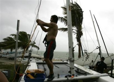
FORT LAUDERDALE, Fla. - Hurricane Katrina churned through Florida's densely populated southeastern coast Thursday with sustained winds of 80 mph and lashing rain. Two people were killed by falling trees.


The storm strengthened into a Category 1 hurricane just before it made landfall along the Miami-Dade and Broward county line between Hallandale Beach and North Miami Beach. Weather officials said flooding was the main concern as the storm dropped a foot of rain or more in some spots.

Rain fell in horizontal sheets, seas were estimated at 15 feet and blew gusts of up to 92 mph, toppling trees and street signs. Florida Power & Light said more than 412,000 customers were without electricity.

Late Thursday, Katrina was centered in northwest Miami-Dade County, heading west at 6 mph. An estimated 5.9 million Florida residents were in Katrina's projected path.

The storm proved fatal for two people who ignored warnings to stay inside until the worst was over. A man in his 20s in Fort Lauderdale was crushed by a falling tree as he sat alone in his car, while a pedestrian was killed by a falling tree in the Fort Lauderdale suburb of Plantation.

"The message needs to be very clear. It's not a good night to be out driving around," National Hurricane Center director May Mayfield. "The back side of the core of the hurricane has yet to come. It's not over yet."

The usually bustling streets of Miami Beach, a tourist haven, were largely deserted as the storm pounded the area. The city is hosting celebrities and partygoers in town for the MTV Video Music Awards. MTV called off its pre-awards festivities Thursday and Friday.

"It's like a ghost town out here," said Mark Darress, concierge at The Astor Hotel in Miami Beach. "I see the random, not so smart people, riding scooters every now and then."

Tourists and others hoping to get out of town before the storm were stranded as airlines canceled flights at Miami and Fort Lauderdale airports, which both closed Thursday night.

Three mobile home parks in Davie sustained considerable damage, according to the Broward Emergency Management Agency. "A lot of roofs are off," said Dennis Myers, a spokesman for the agency.

When the eye of the hurricane passed over the National Hurricane Center in west Miami-Dade County, forecasters ran outside to experience the calm at the center of the storm.

In an oceanfront condominium in Hallandale, Carolyne and Carter McHyman said heavy downpours once again pelted their windows after the eye passed.

"It's been horrible," Carolyne McHyman said. "Basically all our windows are leaking. We just keep mopping up and taping the windows, mopping up and taping again."

Before the hurricane struck, Floridians wary of Katrina prepared by putting up shutters, stacking sandbags in doorways and stocking up on supplies.

At a supermarket in Hollywood, Cassandra Butler hefted two five-gallon bottles of water as well as a 24-pack of smaller bottles into her shopping cart Thursday.

"It's not that I'm worried. I've been in south Florida all my life," Butler said. "But this is a feature of life down here, and you are smart to deal with it."

At a Home Depot in Miami, Jose Guerrera, 68, loaded 4-by-8 sheets of plywood onto a metal cart. He and his family huddled in their Coral Gables home as Hurricane Andrew screamed by in 1993 and he has been boarding up the house during hurricanes ever since.

"I have to protect the doors and windows," Guerrera said. His wife, meanwhile, was shopping for water and food. "That's her problem. She's gotta take care of the food. I take care of the work."

Water management officials lowered canal levels to avoid possible flooding, and pumps were activated in several low-lying areas of Miami-Dade.

Dozens of surfers and spectators lined beaches from Palm Beach to Miami-Dade counties to take advantage of the massive waves on the normally placid seas, and long lines didn't seem to be a problem at most area gas stations, supermarkets and hardware stores.

"This is the best of both worlds because it'll bring great waves, but it is not at all dangerous," said surfer Kurt Johnston, 22, of Davie.

Katrina was the second hurricane to hit the state this year — Dennis hit the Panhandle last month — and the sixth since Aug. 13, 2004. Katrina formed Wednesday over the Bahamas and was expected to cross Florida before heading into the Gulf of Mexico.

After crossing the peninsula, the storm could turn to the north over the Gulf of Mexico and threaten the Panhandle early next week, forecasters said. Bush encouraged residents of Florida's Panhandle and Big Bend areas to monitor the storm.

Katrina is the 11th named storm of the Atlantic hurricane season, which began June 1. That's seven more than have typically formed by now in the Atlantic, Caribbean and Gulf of Mexico, the hurricane center said. The season ends Nov. 30.

___

On the Net:

National Hurricane Center: http://www.nhc.noaa.gov

http://news.yahoo.com/news?tmpl=story&u=/ap/20050826/ap_on_re_us/tropical_weather
📎 aff
Đăng nhập để trả lời
0
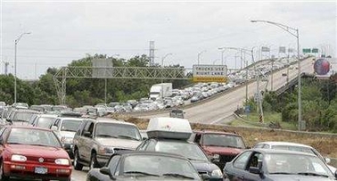
Reuters - Mon Aug 29, 8:22 AM ET Tourist and residents stream north on Interstate 10 as they evacuate New Orleans, Louisiana in an attempt to flee Hurricane Katrina August 28, 2005. Authorities in New Orleans ordered hundreds of thousands of residents to flee as Hurricane Katrina strengthened into a rare top-ranked storm and barrelled towards the vulnerable U.S. Gulf Coast city. REUTERS/Mark Wallheiser


📎 afee
Đăng nhập để trả lời
0
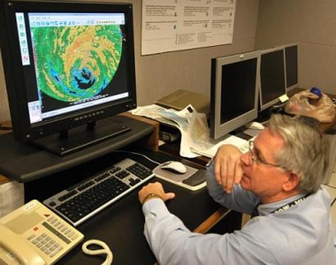
AP - Mon Aug 29, 8:20 AM ET Hurricane specialist Stacy Stewart watches Hurricane Katrina come ashore at Plaquemines Parrish, La., just south of Buras at about 7:10 a.m., EDT Monday, Aug. 29, 2005, on a video monitor at the National Hurricane Center in Miami. (AP Photo/Andy Newman)

📎 aaaaaaa
Đăng nhập để trả lời
0
AP - Mon Aug 29, 8:23 AM ET National Hurricane Center Max Mayfield, left, talks to a doctor at Turo Infirmary in New Orleans, while Billy Wagner, a hurricane liaison team member for the Federal Emergency Management Agency, shows the stress of Hurricane Katrina Monday, Aug. 29, 2005, at the National Hurricane Center in Miami. (AP Photo/Andy Newman)

📎 asd
Đăng nhập để trả lời
0
Katrina's Worst May Not Hit New Orleans
AP - 11 minutes ago
NEW ORLEANS -Hurricane Katrina turned slightly to the east before slamming ashore early Monday with 145-mph winds, providing some hope that the worst of the storm's wrath might not be directed at this vulnerable, below-sea-level city. Katrina, which weakened slightly overnight to a Category 4 storm, turned slightly eastward before hitting land, which would put the western eyewall — the weaker side of the strongest winds — over New Orleans.

http://news.yahoo.com/fc/world/hurricanes_and_tropical_storms
Đăng nhập để trả lời
0
AFP/Getty Images - Mon Aug 29, 4:26 AM ET Residents wait in line to enter the Superdome which is being used as an emergency shelter before the arrival of Hurricane Katrina in New Orleans, Louisiana. Tens of thousands of people fled New Orleans amid fears of a catastrophe as Hurricane Katrina barreled toward the low-lying southern US city(AFP/Getty Images/Mario Tama)

📎 aa
Đăng nhập để trả lời
0
Katrina's Worst May Not Hit New Orleans

AP - 38 minutes ago

NEW ORLEANS -Hurricane Katrina turned slightly to the east before slamming ashore early Monday with 145-mph winds, providing some hope that the worst of the storm's wrath might not be directed at this vulnerable, below-sea-level city. Katrina, which weakened slightly overnight to a Category 4 storm, turned slightly eastward before hitting land, which would put the western eyewall — the weaker side of the strongest winds — over New Orleans.


http://news.yahoo.com/fc/world/hurricanes_and_tropical_storms

📎 acar
Đăng nhập để trả lời
0
AP - Mon Aug 29, 9:04 AM ET The waters of Lake Pontchartrain surge over a road early Monday, Aug. 29, 2005 in Lacombe, La., as Hurricane Katrina moved ashore about 100 miles away. (AP Photo/Mari Darr~Welch)

📎 alake
Đăng nhập để trả lời
0
New Orleans Facing Environmental Disaster

By MATT CRENSON, AP National Writer


26 minutes ago


When Hurricane Katrina hits New Orleans on Monday, it could turn one of America's most charming cities into a vast cesspool tainted with toxic chemicals, human waste and even coffins released by floodwaters from the city's legendary cemeteries.


Experts have warned for years that the levees and pumps that usually keep New Orleans dry have no chance against a direct hit by a Category 5 storm.

That's exactly what Katrina was as it churned toward the city. With top winds of 160 mph and the power to lift sea level by as much as 28 feet above normal, the storm threatened an environmental disaster of biblical proportions, one that could leave more than 1 million people homeless.

"All indications are that this is absolutely worst-case scenario," Ivor van Heerden, deputy director of the Louisiana State University Hurricane Center, said Sunday afternoon.

The center's latest computer simulations indicate that by Tuesday, vast swaths of New Orleans could be under water up to 30 feet deep. In the French Quarter, the water could reach 20 feet, easily submerging the district's iconic cast-iron balconies and bars.

Estimates predict that 60 percent to 80 percent of the city's houses will be destroyed by wind. With the flood damage, most of the people who live in and around New Orleans could be homeless.

"We're talking about in essence having — in the continental United States — having a refugee camp of a million people," van Heerden said.

Aside from Hurricane Andrew, which struck Miami in 1992, forecasters have no experience with Category 5 hurricanes hitting densely populated areas.

"Hurricanes rarely sustain such extreme winds for much time. However we see no obvious large-scale effects to cause a substantial weakening the system and it is expected that the hurricane will be of Category 4 or 5 intensity when it reaches the coast," National Hurricane Center meteorologist Richard Pasch said.

As they raced to put meteorological instruments in Katrina's path Sunday, wind engineers had little idea what their equipment would record.

"We haven't seen something this big since we started the program," said Kurt Gurley, a University of Florida engineering professor. He works for the Florida Coastal Monitoring Program, which is in its seventh year of making detailed measurements of hurricane wind conditions using a set of mobile weather stations.

Experts have warned about New Orleans' vulnerability for years, chiefly because Louisiana has lost more than a million acres of coastal wetlands in the past seven decades. The vast patchwork of swamps and bayous south of the city serves as a buffer, partially absorbing the surge of water that a hurricane pushes ashore.

Experts have also warned that the ring of high levees around New Orleans, designed to protect the city from floodwaters coming down the Mississippi, will only make things worse in a powerful hurricane. Katrina is expected to push a 28-foot storm surge against the levees. Even if they hold, water will pour over their tops and begin filling the city as if it were a sinking canoe.

After the storm passes, the water will have nowhere to go.

In a few days, van Heerden predicts, emergency management officials are going to be wondering how to handle a giant stagnant pond contaminated with building debris, coffins, sewage and other hazardous materials.

"We're talking about an incredible environmental disaster," van Heerden said.

He puts much of the blame for New Orleans' dire situation on the very levee system that is designed to protect southern Louisiana from Mississippi River floods.

Before the levees were built, the river would top its banks during floods and wash through a maze of bayous and swamps, dropping fine-grained silt that nourished plants and kept the land just above sea level.

The levees "have literally starved our wetlands to death" by directing all of that precious silt out into the Gulf of Mexico, van Heerden said.

It has been 40 years since New Orleans faced a hurricane even comparable to Katrina. In 1965, Hurricane Betsy, a Category 3 storm, submerged some parts of the city to a depth of seven feet.

Since then, the Big Easy has had nothing but near misses. In 1998, Hurricane Georges headed straight for New Orleans, then swerved at the last minute to strike Mississippi and Alabama. Hurricane Lili blew herself out at the mouth of the Mississippi in 2002. And last year's Hurricane Ivan obligingly curved to the east as it came ashore, barely grazing a grateful city.

http://news.yahoo.com/s/ap/20050829/ap_on_re_us/katrina_the_big_one
Đăng nhập để trả lời
0
«« « 1 2 3 4 5 » »»